Orlando Urbanization Project
- Orlando, FL
Orlando, Florida is a place built around the automobile. This model of development has been the dominant form of development for the bulk of the city's growth, but is there a better way?
This project proposes a form-based adaptive zoning code that evolves based on the level of transit service. The project also explores how, over time, this redevelopment of Orlando's urban fabric towards pedestrians and transit will allow the city to more comfortably and efficiently house its residents.
As an adaptive zoning code, this project harnesses the natural tendency of cities to evolve over time to implement incremental change. This code views the city as a life-form that metabolizes on the scale of decades, and establishes rules over that timeframe.
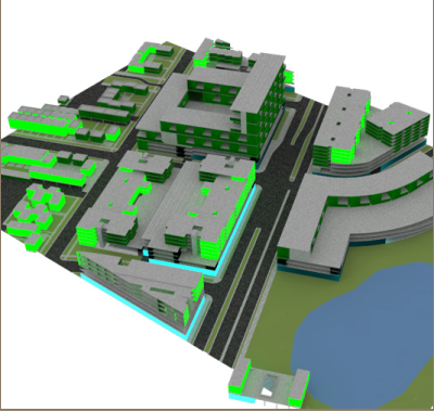
Zoning code in action
The Zoning Code
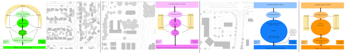
The most fundamental building block of the proposed zoning code is the building archetype. This documents the relationship between the building's spaces and its surroundings.
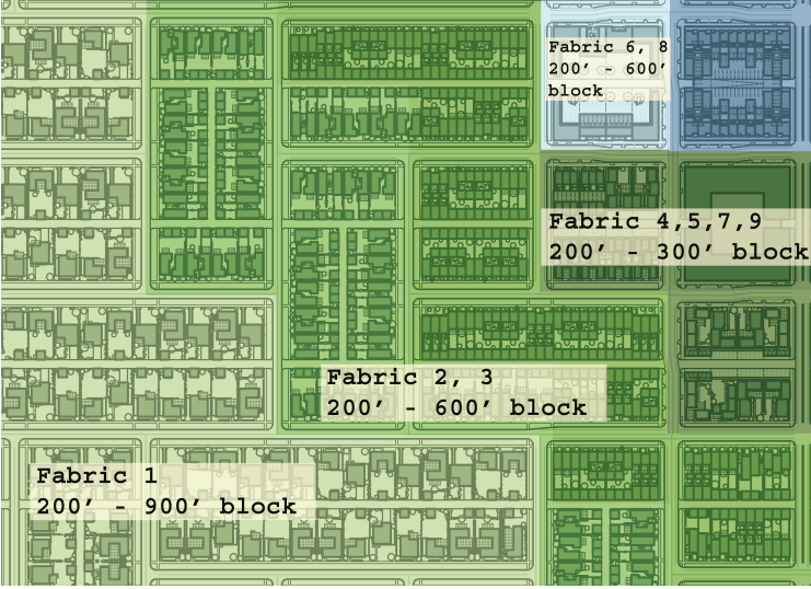
These building blocks are used to create nine fabrcs that regulate the density and relationship of these fundamental building types to each other. The fabrics are hierarchical - over time, each type of fabric can evolve into other fabrics.
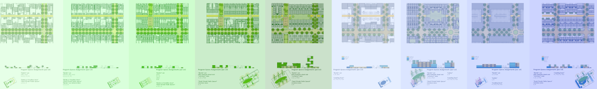
The fabrics are then organized around transit-centered transects that shape the scale of the neighborhood. As transit frequency and type changes, the fabrics evolve to match.
Existing buildings were analyzed to establish building archetypes.
Building archetypes were organized into nine different fabrics.
Fabrics arrange into transects, based on level of transit service. As transit service changes, fabrics evolve to reflect this change.
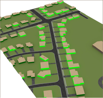
Locations of exploration of zoning code
Future Exploration of Zoning Code Implementation
Using existing GIS data layers and the proposed zoning code, the project explores the effects of this code's implementation. The zoning code is applied to the neighborhood by anticipating future transit development patterns.
The zoning code provides a cohesive strategy of development to occur incrementally, and also calls for the unbuilding of some environmentally sensitive areas in the extreme northern headwaters of Florida's Everglades. Over time, the scale of the neighborhood shifts from the scale of an automobile traveling at high speeds to the scale of a pedestrian.
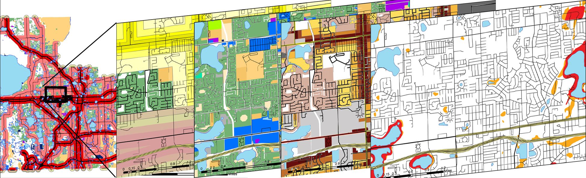
Analysis of urban fabric was conducted using GIS to evaluate existing land use patterns and establish new patterns.
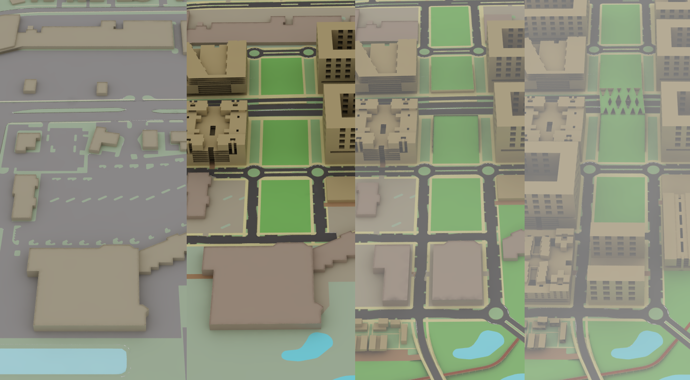
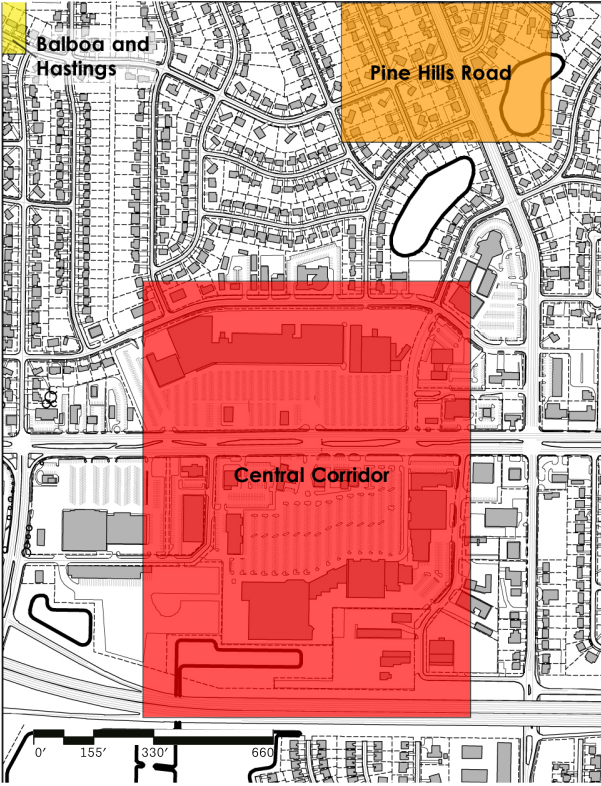
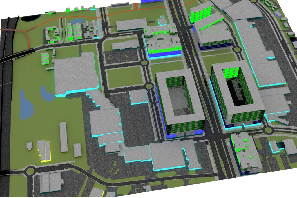
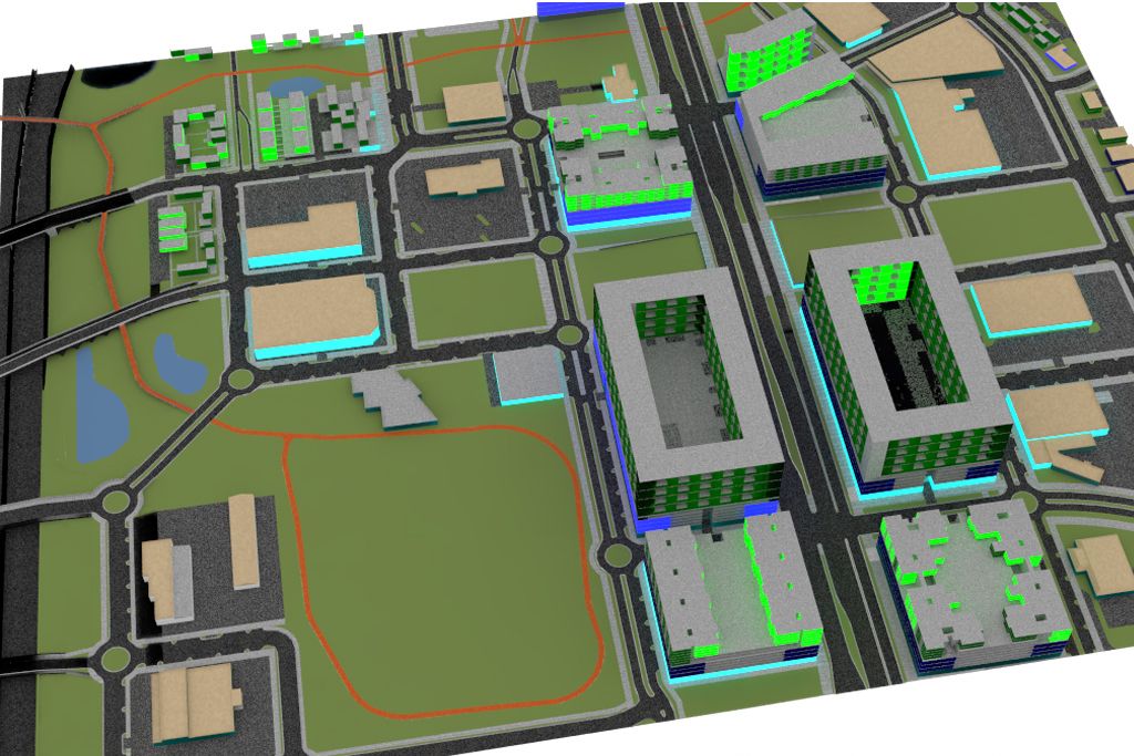
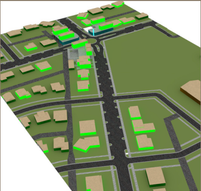
Central Corridor
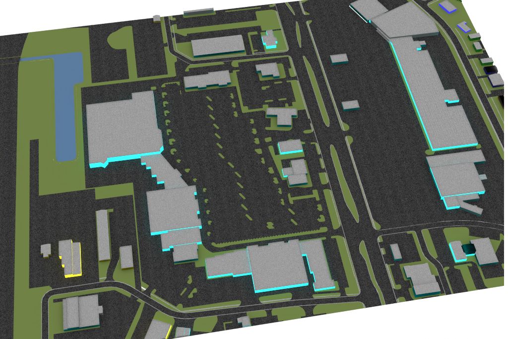
Central Corridor's initial state - a collection of commercial strip malls around a major automobile thoroughfare
First stage of Central Corridor's evolution - build on the parking lots
Second stage of Central Corridor's evolution - a mix of building and unbuilding in sensitive areas.
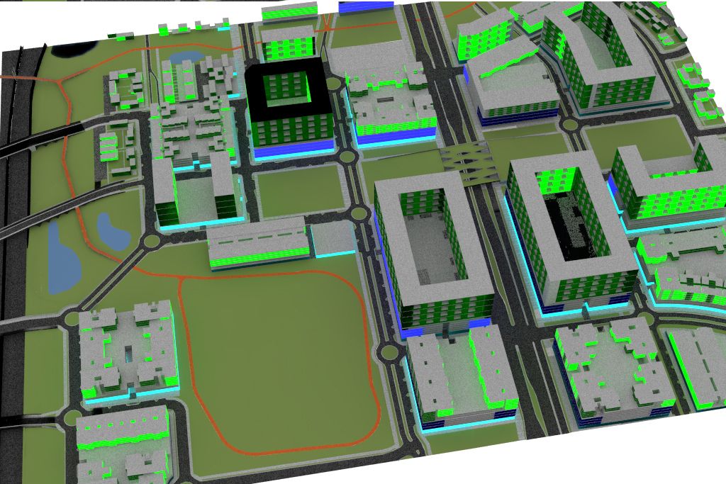
Third stage of Central Corridor's evolution - expand as transit improves, older buildings fall apart
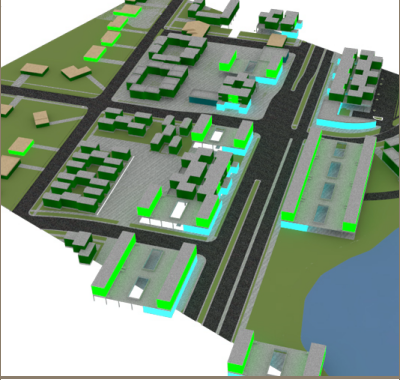
Pine Hills Road
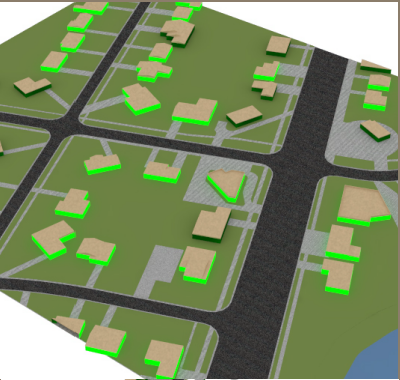
Pine Hills Road's initial state - disaggregated single family homes
First stage of Pine Hills Road's evolution - redevelop at scale of single family lot
Second stage of Pine Hills Road's evolution
- intensification of development
Balboa and Hastings
Pine Hills Road's initial state - disaggregated single family homes
Second stage of B+H's evolution - develop central node at scale of single family lot