Soundscape Mapping Method
- Port Angeles, WA
Decibels aren't intuitive, but the actual sounds we hear are. Using sound recording and mapping methods, GIS analysis, and statistics, I developed a way to map and evaluate our world by sound that goes beyond engineering measurements of physical energy.
Why is this measurement method important?
A waterfall and a noisy highway might have similar levels of sound, but will be perceived and valued very differently by listeners. Current methods of mapping don't allow for crucial distinctions like this to be made. However, there is a lot of power in being able to evaluate a soundscape in this way:
- Designers can distinguish between wanted and unwanted sounds to develop appropriate design strategies.
- Different types of listeners (sleepers, office workers, birds) can evaluate the same sonic landscape in a more refined way. When multiple perspectives are combined into a similar framework, decisions about noise pollution can easily be evaluated for their benefits and tradeoffs across all parties.
- Sound is often evidence of something else. By documenting the type of sound in addition to its level, researchers can easily correlate sound to trends (such as, say, elk populations).
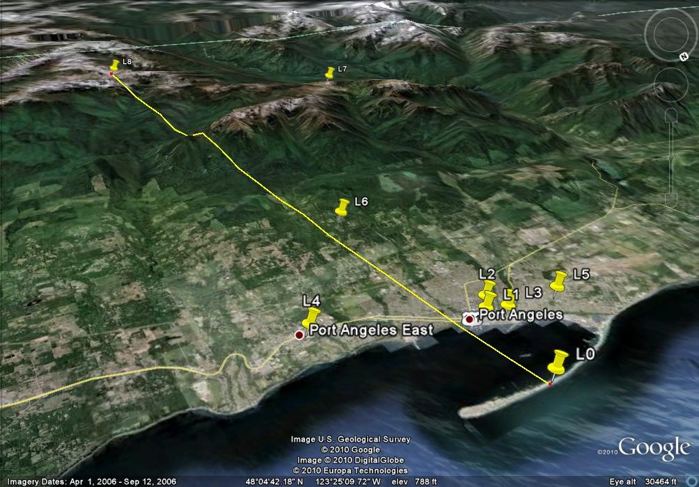
Area of study
How it works
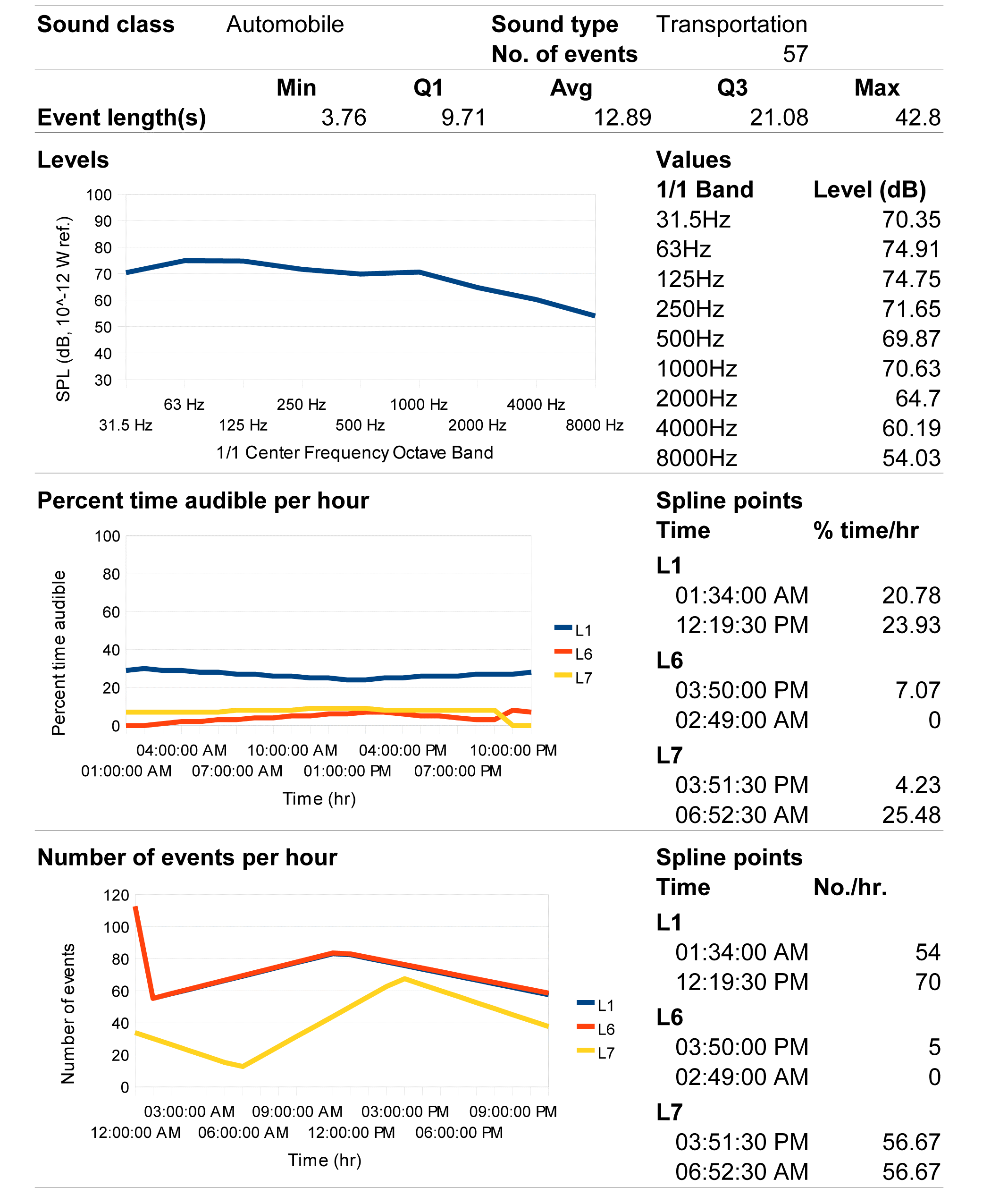
Calibrated measurements are synchronized with field recordings to break the sonic landscape down into its discrete, analyzable components. From a sound's type, level, and probability of occurrence, listeners can evaluate the suitability of a sonic landscape for themselves.
The following images show the general data flows and processes for this method. I wrote software for analysis of the synchronized measurements and audio files. The analysis produced by this software was linked into a GIS database that included statistical measurements and calculated sound levels, which formed the basis for analysis.
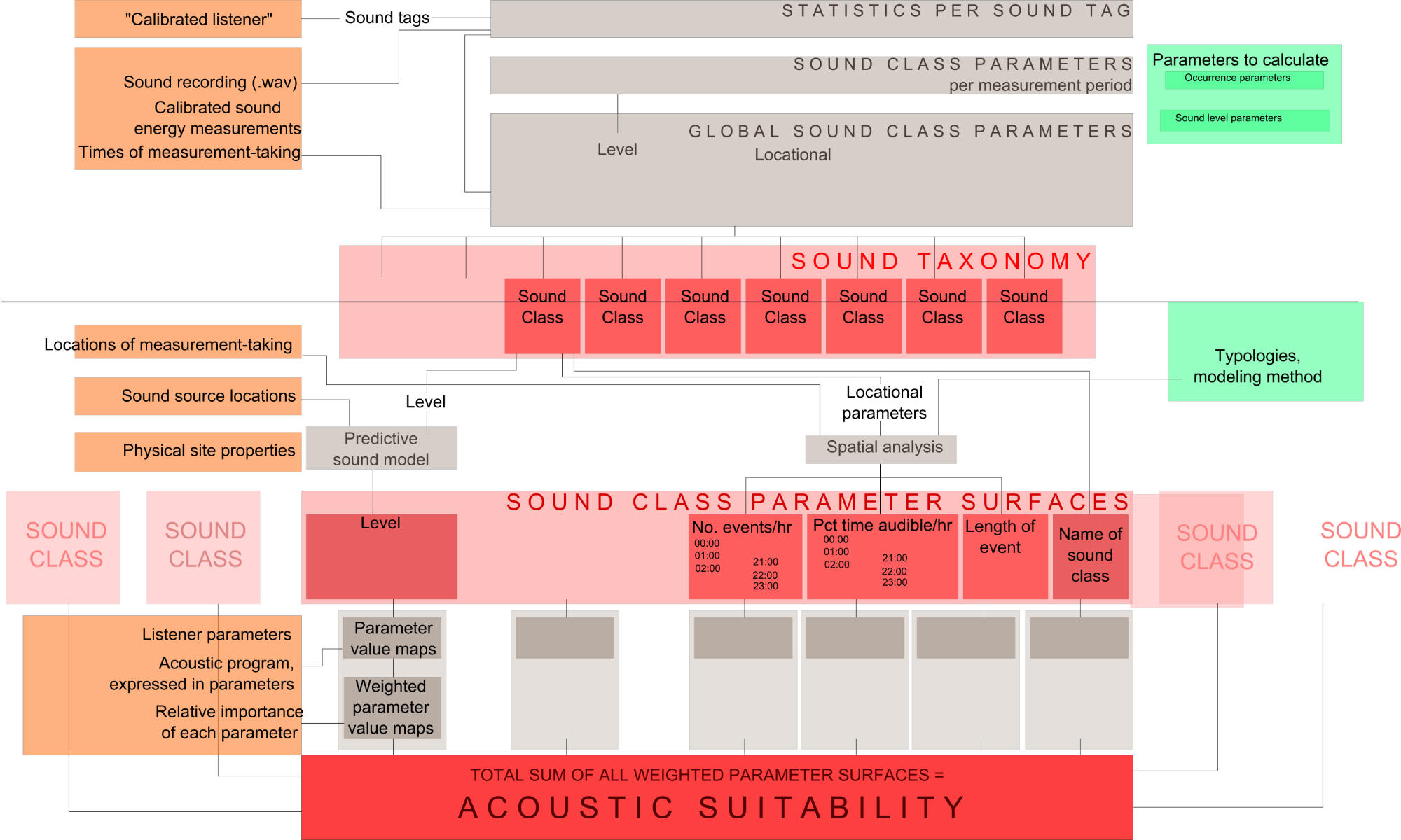
Data flow used by the program / method
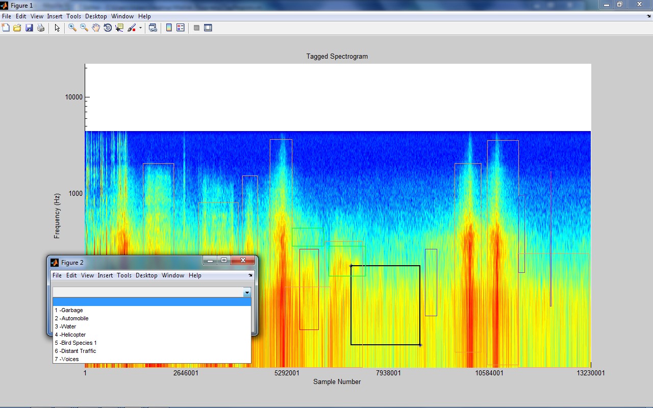
Software developed for assisted listening and soundscape analysis. The sound file is tagged to identify and analyze individual sounds.
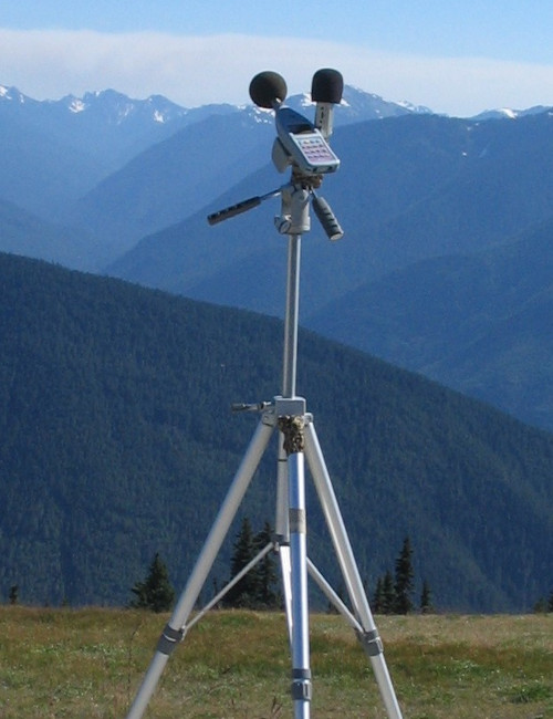
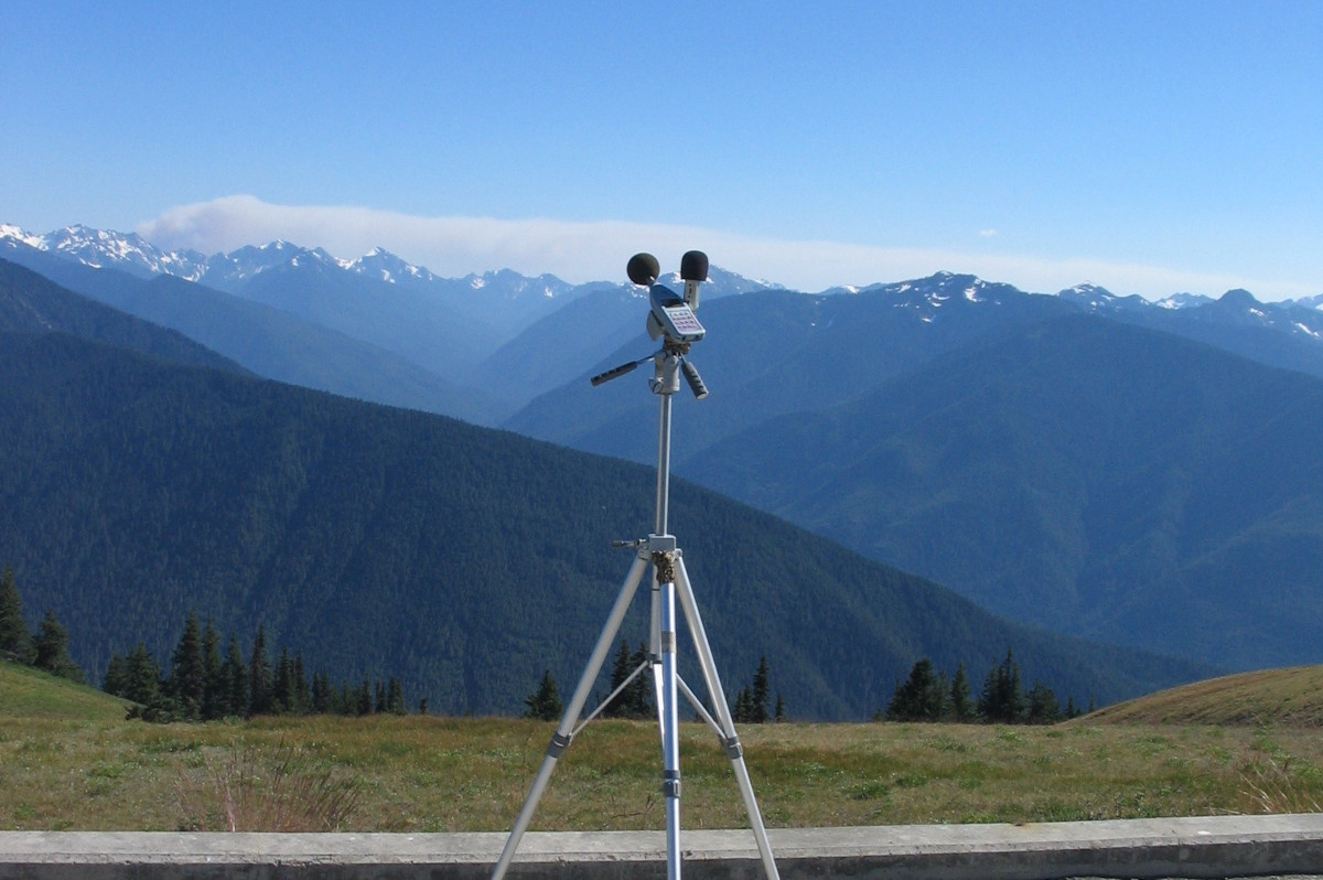
Apparatus - synchronized omnidirectional calibrated sound logger and multi-channel spatial audio recorder
Database developed for each sound, by location
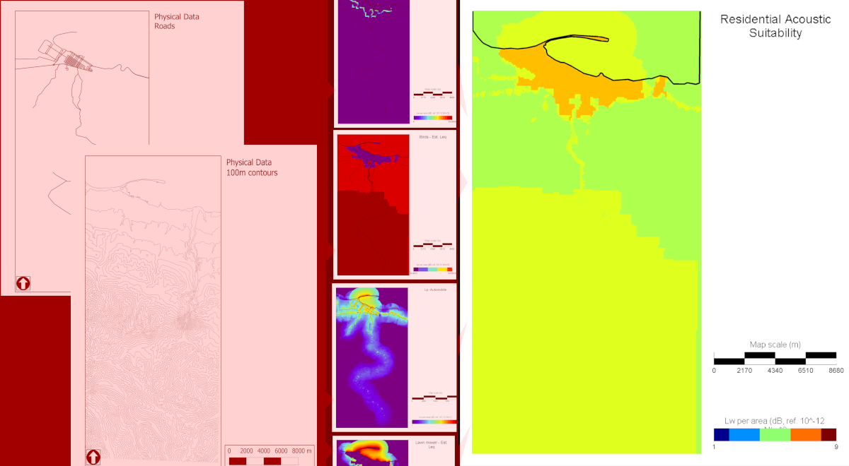
Sounds are mapped using publicly available GIS data and sound mapping software.
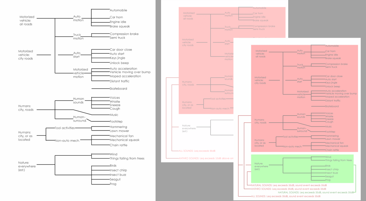
Sounds on the site are sorted in a taxonomy for different users to evaluate, and the maps are used to estimate suitability.